Cover Foto

Danie van der Merwe

gadgeteer@hub.netzgemeinde.eu

Channel Apps
Bringing OpenStreetMap Data Into Minecraft

vor 3 Monaten
gadgeteer@hub.netzgemeinde.eu
Bringing OpenStreetMap Data Into Minecraft

Over the years, dedicated gamers have created incredible recreations of real (and not so real) locations and structures within the confines of Minecraft. Thanks to their efforts, you can explore everything from New York city to Middle Earth and the U.S.S. Enterprise in 1:1: scale.

But what if you wanted to recreate your own town, and didn’t have the hundreds of hours of spare time necessary to do it by hand? Enter Arnis, an open source project from [Louis Erbkamm] that can pull in geographic data from OpenStreetMap and turn it into a highly detailed Minecraft map with just a few keystrokes.

Once generated, the map can be loaded into the Java Edition of Minecraft. This refers to the original build of the game that predates the Microsoft buyout.

Looks like a pretty interesting holiday project!

See Bringing OpenStreetMap Data Into Minecraft

Bild/Foto

Over the years, dedicated gamers have created incredible recreations of real (and not so real) locations and structures within the confines of Minecraft. Thanks to their efforts, you can explore ev…


#technology #gaming #openstreetmap #minecraft
HP-1973 is a Python simulator app for the retro HP-45 calculator and 5 other HP ROMs, written by Sarah K. Marr

vor 1 Jahr
gadgeteer@hub.netzgemeinde.eu
The app was written in Python and started out for the HP-45 (ROM is included) but finally included also the HP-35 and the HP-80, as well as three others. For macOS and Windows you could just run the included executables, or with the Python code, this will run fine on Linux if you have Python installed. Nice thing is that you can also modify or tweak the Python code if you wish.

As she states, this is not a "how to learn HP or RPN" but there is a lot of included online help, and the original HP manuals are available online.

What an amazing resource for anyone wanting to learn more about the inner workings of these legendary calculators.

See https://sarahkmarr.com/retrohp1973.html

hp1973ExplodedView.jpg

#technology #opensource #Python #HP1973 #HP45
StreetComplete is a gamified Android app specifically for casual contributors to OpenStreetMap Editor for mapping in the field

vor 1 Jahr
gadgeteer@hub.netzgemeinde.eu
The app is made specifically for casual contributors and beginners as no prior knowledge about OpenStreetMap (such as tagging schemes) is required to contribute with this app. Furthermore, there is a bit of gamification and statistics that aim to introduce and try to inspire users to venture deeper into the world of OpenStreetMap.

This app finds missing map data in your vicinity and displays it on a map as quests. Solve each quest by visiting the location on-site and answering a simple question to update the map.

The info you enter is directly added to OpenStreetMap in your name, without the need to use another editor. OpenStreetMap is a really valuable free resource that anyone can contribute to, and which numerous mobile apps also use for their navigation. It is the Wikipedia of Mapping!

The app is open source and is available both on the Google app store but also on the F-Droid store.

See StreetComplete - OpenStreetMap Wiki

Streetcomplete.jpg

StreetComplete is an easy to use OpenStreetMap editor for Android phones and tablets, used for mapping in the field. The app is made specifically for casual contributors and beginners as no prior knowledge about OpenStreetMap (such as tagging schemes) is required to contribute with this app. Furthermore, there is a bit of gamification and...


#technology #OpenStreetMap #StreetComplete #opensource #mapping
Magic Earth: A New Google Maps Alternative Launches on Android Auto based on OpenStreetMap

vor 1 Jahr
gadgeteer@hub.netzgemeinde.eu
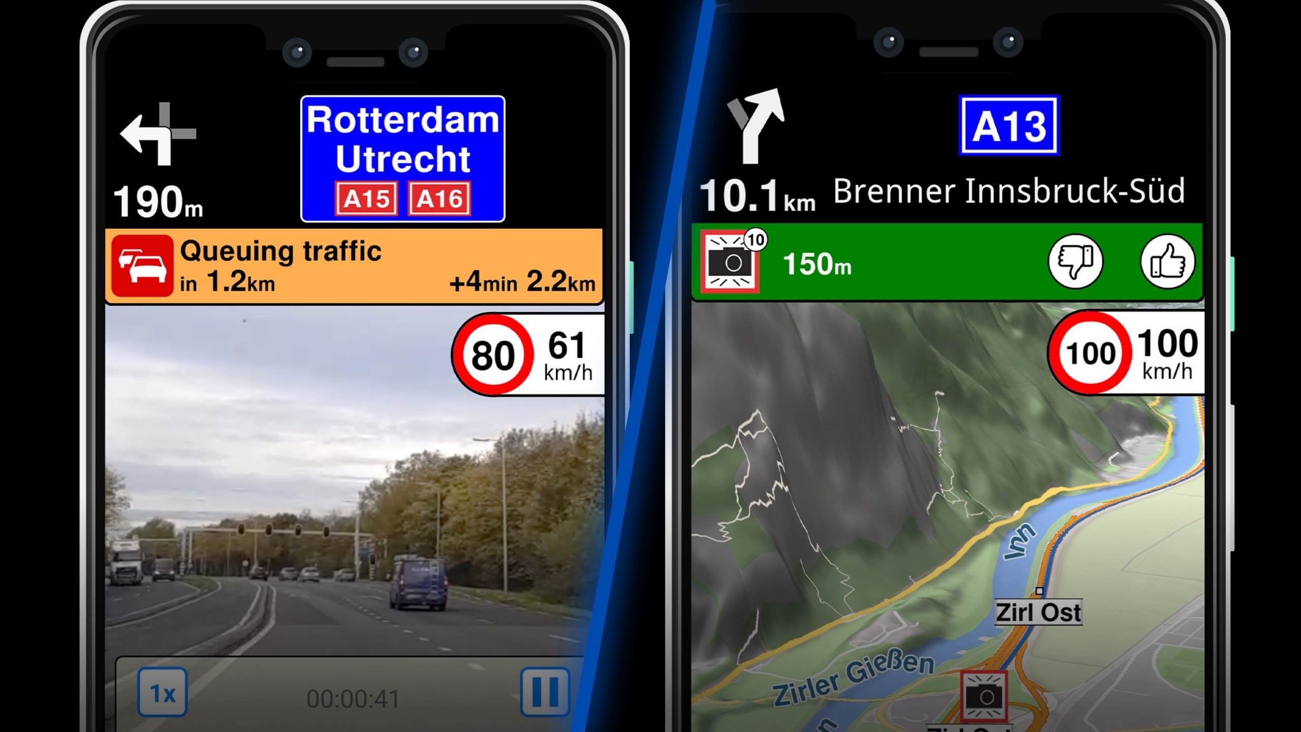
Magic Earth now supports Advanced Driver Assistance System (ADAS) systems powered by the phone’s camera. The application can monitor the road ahead and provide functionality otherwise available in integrated ADAS technology fitted into the car. The application offers lane departure warnings, traffic sign recognition, and forward and pedestrian collision notifications.

The navigation application, which retains its focus on user privacy and offline route guidance, also brings most features to Android Auto. Magic Earth now supports truck navigation, letting users enter vehicle information. For example, the application can look for routes based on certain vehicle parameters, such as width, height, length, weight, and axle weight. Once all these details are provided, Magic Earth only configures appropriate routes, avoiding narrow roads, low bridges, and sharp curves.

I tested it out today, but in my case, the version I just downloaded did not yet recognise Android Auto. Just like OsmAnd it is based on OpenStreetMap. It has a much simpler, but I'd say better looking, interface than OsmAnd. Any new interface of course takes a bit of time to get used to. OsmAnd does also have all the truck navigation features previously mentioned, and it has a ton more settings and options (for example also speed bump and pedestrian crossing warnings), but many may find OsmAnd a bit more complex. If so, then Magic Earth may be well worth trying out.

Magic Earth says they are privacy first with no tracking, no profiling, don't trade in our personal data, and don't have our personal data.

It does have options for traffic and re-routing (and I'm not sure how the traffic data is working) but I suppose the proof of the pudding for many will be, how well does it route in real life. You can however also tweak these settings for cars, bicycles and walking (I imagine trucks is in the newer version I don't seem to have yet).

See A New Google Maps Alternative Launches on Android Auto With Massive Update

#technology #navigation #MagicEarth #OpenStreetMap

Bild/Foto

While for many people, the navigation space comes down to Google Maps and Waze, this app category includes several other worthy names. Magic Earth is one...

Organic Maps is an open source privacy respecting Android & iOS offline maps app based on OpenStreetMap data

vor 3 Jahren
gadgeteer@hub.netzgemeinde.eu
Organic Maps is pure and organic, made with love: Respects your privacy, saves your battery, and has no unexpected mobile data charges.

Organic Maps is free from trackers and other bad stuff:
* No ads
* No tracking
* No data collection
* No phoning home
* No annoying registration
* No mandatory tutorials
* No noisy email spam
* No push notifications
* No crapware

See Organic Maps

#technology #opensource #maps #openstreetmap #navigation

Bild/Foto

Fast detailed offline maps for travelers, tourists, hikers and cyclists curated with love by MAPS.ME founders